| 1. What is the distance from the equator to the southern tip of India? = 876 km.
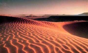
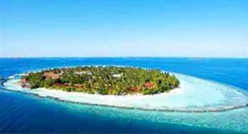
2. What is the length of the land border of India? = 15200 km. 3. What is the length of the coastline of the mainland of India? = 6100 km. 4. What is the length of the total coastline (including island groups) of India? = 7516 km. 5. What percentage of the whole of India is covered by mountains and hills? = 28.8%. 6. How much area of the whole of India is the plain expansion? = 44%. 7. What is the number of states having coastlines in India? = 09. 8. Which state has the longest coastline? = Gujarat. 9. Tropic of Cancer passes through how many states of India? = 08. 10. Which place is near the equator? = Indira Point. 11. Where is Indira Point situated? = in the Andaman-Nicobar Islands. 12. Which state has the shortest coastline? = Goa. 13. India’s land border with which country is maximum? = Bangladesh. 14. Which physiographic part of India is ancient? = Peninsular Plateau. 15. what name is the eastern seaboard of India known? = Coromandel Coast. 16. where to here is the Konkan coast situated? = Goa to Daman. 17. who the islands of the Lakshadweep group were originated? = by coral. 18. Where is New Moore Island situated? = In the Andaman Sea. 19. Which island is situated between India and Sri Lanka? = Rameshwaram. 20. What is the total number of islands in the Lakshadweep group? = 36. 21. How many islands in the Lakshadweep group do humans live? = 10. 22. Which place in India is known as ‘White Water’? = Siachen. 23. That part of Jammu and Kashmir which is under the authority of China, is? = Says Oxai China. 24. Which is the cold desert in India? = Ladakh. 25. Which country India has a dispute over New Moore Island? = Bangladesh. 26. The Union Territory of Dadar Nagar Haveli is situated between which of the following states of India? = Gujarat and Maharashtra. 27. Which state was earlier known as NEFA? = Arunachal Pradesh. 28. Which island is Port Blair, the capital of the Union Territory of Andaman and Nicobar Islands, located? = South Andaman. 29. Which state is not a part of the ‘Seven Sisters of North Eastern States? = Sikkim and West Bengal. ======== ========== ============ 1. भूमध्य रेखा से भारत के दक्षिण छोर की दूरी कितनी है? = 876 कि०मी०. 2. भारत की स्थल सीमा की लंबाई कितनी है? = 15200 कि०मी०. 3. भारत की मुख्य भूमि की तटरेखा की लंबाई कितनी है? = 6100 कि०मी०. 4. भारत की कुल तटरेखा की लंबाई (द्वीप समूहों सहित) कितनी है? = 7516 कि०मी०. 5. संपूर्ण भारत के कितने % भाग पर पर्वत व पहाड़ियों का विस्तार है? = 28.8%. 6. संपूर्ण भारत के कितने क्षेत्रफल पर मैदानी विस्तार है? = 44%. 7. भारत में समुद्र तटरेखा वाले राज्यों की संख्या कितनी है? = 09. 8. किस राज्य की समुद्र तटरेखा सबसे लंबी है? = गुजरात. 9. कर्क रेखा भारत के कितने राज्यों से होकर जाती है? = 08. 10. भूमध्य रेखा के निकट कौन-सा स्थान है? = इंदिरा प्वाइंट. 11. इंदिरा प्वाइंट कहाँ स्थित है? = अंडमान-निकोबार द्वीप समूह में. 12. किस राज्य की समुद्र तटरेखा सबसे छोटी है? = गोवा. 13. भारत की स्थल सीमा किस देश के साथ सबसे ज्यादा है? = बांग्लादेश के साथ. 14. भारत का कौन-सा भू-आकृतिक भाग प्राचीन है? = प्रायद्वीपीय पठार. 15. भारत के पूर्वी समुद्र तट को किस नाम से जाना जाता है? = कोरोमंडल तट. 16. कोंकण तट कहाँ से यहाँ तक स्थित है? = गोवा से दमन तक. 17. लक्षद्वीप समूह के द्वीपों की उत्पत्ति किसके द्वारा हुई? = प्रवाल. 18. न्यू मूर द्वीप कहाँ स्थित है? = अंडमान सागर. 19. कौन-सा द्वीप भारत और श्रीलंका के बीच में स्थित है? = रामेश्वरम्. 20. लक्षद्वीप समूह के कुल द्वीपों की संख्या कितनी है? = 36. 21. लक्षद्वीप समूह में कुल कितने द्वीपों पर मानव रहते हैं? = 10. 22. भारत के किस स्थान को ‘सफेद पानी’ के नाम से जाना जाता है? = सियाचिन. 23. जम्मू-कश्मीर का वह हिस्सा जो चीन के अधिकार में है, उसे? = ऑक्साई चीन कहते हैं. 24. भारत में शीत मरूस्थल कौन-सा है? = लद्दाख. 25. किस देश के साथ न्यू मूर द्वीप के कारण भारत का विवाद है? = बांग्लादेश के साथ. 26. केंद्रशासित प्रदेश दादर नगर हवेली भारत के किन राज्यों के बीच में स्थित है? = गुजरात व महाराष्ट्र. 27. किस राज्य को पहले NEFA के नाम से जाना जाता था? = अरुणाचल प्रदेश. 28. केंद्रशासित प्रदेश अंडमान-निकोबार द्वीपसमूह की राजधानी पोर्ट ब्लेयर किस द्वीप पर स्थित है? = दक्षिण अंडमान. 29. कौन-सा राज्य उत्तरी पूर्वी राज्य की ‘सात बहनों’ का भाग नहीं है? = सिक्किम व पश्चिमी बंगाल.
|