|
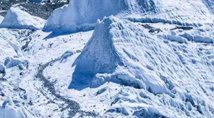
1. क्षेत्रफल की दृष्टि से भारत का विश्व में कौन-सा स्थान है? = 07वां. 2. जनसंख्या की दृष्टि से भारत का विश्व में कौन-सा स्थान है? = 02. 3. भारत किस गोर्ला में स्थित है? = उत्तरी. 4. भारत के उत्तर में कौन-कौन-से देश हैं? = चीन, नेपाल और भूटान. 5. भारत के पूर्व में कौन-सा देश है? = बांग्लादेश. 6. भारत के पश्चिम में कौन-सा देश है? = पाकिस्तान. 7. भारत के दक्षिण पश्चिम में कौन-सा सागर है? = अरब सागर. 8. भारत के दक्षिण में कौन-सा महासागर है? = हिन्द महासागर. 9. भारत के दक्षिण-पूर्व में कौन-सी खाड़ी है? = बंगाल की खाड़ी. 10. पूर्वांचल की पहाड़ियाँ भारत को किस देश से अलग करती हैं? = म्यांमार से. 11. मन्नार की खाड़ी और पाक जलडमरूमध्य भारत को किस देश से अलग करते हैं? = श्रीलंका से. 12. संपूर्ण भारत की अंक्षाशीय विस्तार कितना है? = 8° 4’ से 37°6’ उत्तरी अक्षांश. 13. भारत के मध्य से कौन-सी रेखा गुजरती है? = कर्क रेखा. 14. भारत की देशांतर स्थिति क्या है? = 68°7’ से 97°25’ तक. 15. कौन-सा महत्वपूर्ण अक्षांश भारत को दो भागों में बांटता है? = 23°3’ उत्तर. 16. भारत के उत्तर से दक्षिण तक विस्तार कितना है? = 3214 किमी. 17. भारत का पूर्व से पश्चिम तक विस्तार कितना है? = 2933 किमी. 18. अंडमान-निकोबार द्वीप समूह कहाँ स्थित है? = बंगाल की खाड़ी में. 19. लक्षद्वीप कहाँ स्थित है? = अरब सागर में. 20. भारत का दक्षिणी छोर क्या कहलाता है? = इंदिरा प्वाइंट. 21. इंदिरा प्वांइट को किस दूसरे नाम से भी जाना जाता है? = पिगमिलियन प्वाइंट. 22. भारत का क्षेत्रफल विश्व के क्षेत्रफल का कितना है? = 2. 42% 23. विश्व की कुल जनसंख्या का कितने प्रतिशत भारत में निवास करता है? = 17% 24. भारत का कुल क्षेत्रफल कितना है? = 32,87,263 वर्ग कि०मी०. 25. भारत की स्थल सीमा से कौन-से देश लगे हैं? = बांग्लादेश, चीन, पाकिस्तान, नेपाल, वर्मा और भूटान. 26. भारत की जल सीमा किन देशों से मिलती है? = मालदीव, श्रीलंका, बांग्लादेश, म्यांमार व पाकिस्तान. 27. कर्क रेखा किन राज्यों से होकर गुजरती है? = राजस्थान, गुजरात, मध्य प्रदेश, छत्तीसगढ़, झारखंड, पश्चिमी बंगाल, त्रिपुरा और मिजोरम. 28. भारत की मुख्य भूमि की दक्षिणी सीमा कितने अक्षांश है? = 8°4’. 29. भारत का मानक समय कहाँ से लिया गया है? = इलाहाबाद के निकट नैनी नामक स्थान से. 30. भारत के मानक समय और ग्रीनविच समय में कितना अन्तर है? = 5 ½. 31. भूमध्य रेखा से भारत के दक्षिण छोर की दूरी कितनी है? = 876 कि०मी०. 32. भारत की स्थल सीमा की लंबाई कितनी है? = 15200 कि०मी०. 33. भारत की मुख्य भूमि की तटरेखा की लंबाई कितनी है? = 6100 कि०मी०. 34. भारत की कुल तटरेखा की लंबाई (द्वीप समूहों सहित) कितनी है? = 7516 कि०मी०. 35. संपूर्ण भारत के कितने % भाग पर पर्वत व पहाड़ियों का विस्तार है? = 28.8%. 36. संपूर्ण भारत के कितने क्षेत्रफल पर मैदानी विस्तार है? = 44%. 37. भारत में समुद्र तटरेखा वाले राज्यों की संख्या कितनी है? = 09. 38. किस राज्य की समुद्र तटरेखा सबसे लंबी है? = गुजरात. 39. कर्क रेखा भारत के कितने राज्यों से होकर जाती है? = 08. 40. भूमध्य रेखा के निकट कौन-सा स्थान है? = इंदिरा प्वाइंट. 41. इंदिरा प्वाइंट कहाँ स्थित है? = अंडमान-निकोबार द्वीप समूह. 42. किस राज्य की समुद्र तटरेखा सबसे छोटी है? = गोवा. 43. भारत की स्थल सीमा किस देश के साथ सबसे ज्यादा है? = बांग्लादेश के साथ. 44. भारत का कौन-सा भू-आकृतिक भाग प्राचीन है? = प्रायद्वीपीय पठार. 45. भारत के पूर्वी समुद्र तट को किस नाम से जाना जाता है? = कोरोमंडल तट. 46. कोंकण तट कहाँ से यहाँ तक स्थित है? = गोवा से दमन तक. 47. लक्षद्वीप समूह के द्वीपों की उत्पत्ति किसके द्वारा हुई? = प्रवाल द्वारा. 48. न्यू मूर द्वीप कहाँ स्थित है? = अंडमान सागर में. 49. कौन-सा द्वीप भारत और श्रीलंका के बीच में स्थित है? = रामेश्वरम्. 50. लक्षद्वीप समूह के कुल द्वीपों की संख्या कितनी है? = 36. 51. लक्षद्वीप समूह में कुल कितने द्वीपों पर मानव रहते हैं? = 10. 52. भारत के किस स्थान को ‘सफेद पानी’ के नाम से जाना जाता है? = सियाचिन. 53. जम्मू-कश्मीर का वह हिस्सा जो चीन के अधिकार में है, उसे? = ऑक्साई चीन कहते हैं. 54. भारत में शीत मरूस्थल कौन-सा है? = लद्दाख. 55. किस देश के साथ न्यू मूर द्वीप के कारण भारत का विवाद है? = बांग्लादेश. ============= ========== ========= Geography of India…. 1. What is India’s position in the world in terms of area? = 07th. 2. What is India’s position in the world in terms of population? = 02. 3. Which region of India is Gorla located? = Northern. 4. Which countries are to the north of India? = China, Nepal and Bhutan. 5. Which country is to the east of India? = Bangladesh. 6. Which country is to the west of India? = Pakistan. 7. Which sea is in the south-west of India? = Arabian Sea. 8. Which ocean is south of India? = Indian Ocean. 9. Which gulf is in the south-east of India? = Bay of Bengal. 10. The hills of Purvanchal separate India from which country? = From Myanmar. 11. Gulf of Mannar and Palk Strait separate India from which country? = From Sri Lanka. 12. What is the latitudinal extent of entire India? = 8° 4′ to 37° 6′ north latitude. 13. Which line passes through the middle of India? = Tropic of Cancer. 14. What is the longitudinal position of India? =68°7′ to 97°25′. 15. Which important latitude divides India into two parts? =23°3′ North. 16. What is the extent of India from north to south? = 3214 km. 17. What is the extent of India from east to west? = 2933 km. 18. Where are the Andaman and Nicobar Islands located? = In the Bay of Bengal. 19. Where is Lakshadweep located? = In the Arabian Sea. 20. What is the southern end of India called? = Indira Point. 21. What other name is Indira Point also known? = Pygmalion Point. 22. What is the area of India compared to the area of the world? = 2.42% 23. What percentage of the world’s total population lives in India? = 17% 24. What is the total area of India? = 32,87, 263 square kilometres. 25. Which countries are adjacent to India’s land border? = Bangladesh, China, Pakistan, Nepal, Burma and Bhutan. 26. Which countries does India share its water border? = Maldives, Sri Lanka, Bangladesh, Myanmar and Pakistan. 27. Through which states does the Tropic of Cancer pass? = Rajasthan, Gujarat, Madhya Pradesh, Chhattisgarh, Jharkhand, West Bengal, Tripura and Mizoram. 28. What latitude is the southern border of the mainland of India? =8°4′. 29. Where is India’s standard time taken from? = From a place called Naini near Allahabad. 30. What is the difference between India’s standard time and Greenwich time? = 5 ½. 31. What is the distance from the equator to the southern tip of India? = 876 km. 32. What is the length of India’s land border? = 15200 km. 33. What is the length of the coastline of mainland India? = 6100 km. 34. What is the total length of India’s coastline (including island groups)? = 7516 km. 35. What percent of the entire India is covered with mountains and hills? = 28.8%. 36. How much area of entire India is covered with plains? = 44%. 37. What is the number of states with coastline in India? = 09. 38. Which state has the longest coastline? = Gujarat. 39. The Tropic of Cancer passes through how many states of India? = 08. 40. Which place is near the equator? = Indira Point. 41. Where is Indira Point located? = Andaman-Nicobar Islands. 42. Which state has the shortest coastline? = Goa. 43. India has the maximum land border with which country? = With Bangladesh. 44. Which geomorphic part of India is ancient? = Peninsular Plateau. 45. What name is the eastern sea coast of India known? = Coromandel Coast. 46. Where is the Konkan coast located? = From Goa to Daman. 47. Who did the Lakshadweep group of islands originate? = By coral. 48. Where is New Moore Island located? = In Andaman Sea. 49. Which island is situated between India and Sri Lanka? = Rameswaram. 50. What is the total number of islands of Lakshadweep group? = 36. 51. How many islands in the Lakshadweep group do humans live on? = 10. 52. Which place in India is known as ‘white water’? = Siachen. 53. That part of Jammu and Kashmir which is under the control of China? = Says Oxhai China. 54. Which is the cold desert in India? = Ladakh. 55. Which country India has a dispute over New Moore Island? = Bangladesh.
|