भूगोल से संबंधित-96.
| 1. Which line is used to show the distribution of rainfall on the map? = isohite.
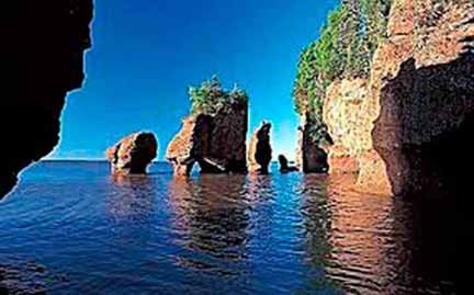
2. What are the lines on the map where the pressure is even called? = isobars. 3. What percentage of the total mass of the Earth is found in the mantle? = 68%. 4. What is the name of the second layer from the top of the three concentric layers of the Earth? = limit. 5. What is the line joining the Earth’s North Pole and the South Pole called? = longitude line. 6. What is the difference between the local time of two places in crossing a longitude? = 4 minutes. 7. What is the number of longitudes? = 360. 8. In which year plate tectonics theory was presented? = in the year 1960. 9. Which is the longest mountain range in the world? = Andes. 10. In which layer of the atmosphere does cloud thunder occur? = Treasury Circle. 11. Lapis is the topography of which region? = karst. 12. What is the topography formed by the erosion of the river? = Gorge. 13. Which elevation did the Himalayas originate? = Tethys. 14. What is the height of ‘Kangchenjunga’, the main peak of the inner Himalayas? = 8598 m. 15. Where do the trade winds blow? = nutrition from high pressure. 16. According to Indian belief, the number of seasons is six in which the season of January-February is? = Shishir. 17. In which ocean is the widest continental coast located in the world? = in the Atlantic Ocean. 18. Where does the growth of ‘plankton’ take place the most? = At the meeting place of cold and hot water streams. 19. The narrow and long mountain ranges like the mountain ranges of land in the oceans are called? = submerged ridge. 20. Which is the world’s smallest ocean? = Arctic Ocean. 21. What is the greatest depth (in meters) of the oceans? = 11,033 m. 22. Who has propounded the progressive wave theory regarding the origin of tides? = William Wavell. 23. ‘El Nino Effect’ is closely related with? = equatorial countercurrent. 24. Where does the highest tide come in the world? = Gulf of Fundy. 25. What is the reason for the rising tides in the oceans? = Effect of the Moon. of the United States of America. 26. Who has propounded the ground subsidence theory related to the origin of coral reefs? = Darwin. 27. Which ocean is suitable for the origin of coral? = tropical ocean. 28. Which natural region is covered with snow throughout the year? = Tundra Pradesh. 29. Where is the Mediterranean climate not found? = in Bolivia. 30. What is the Mediterranean region called? = Entrepreneurial Region. 31. Most of the countries of South-East Asia come under which natural region? = monsoon region. ========== ========== =========== 1. मानचित्र पर वर्षा का वितरण दिखाने के लिए किस रेखा का प्रयोग किया जाता है? = आइसोहाइट. 2. मानचित्र में वे रेखाएँ जहाँ दाब सम हो, क्या कहलाती है? = समदाब रेखाएँ. 3. पृथ्वी के कुल द्रव्यमान का लगभगकितना प्रतिशत मेंटल (Mantle) में पाया जाता है? = 68%. 4. पृथ्वी की तीन संकेन्द्री परतों में ऊपर से दूसरी परत का नाम क्या है? = सीमा. 5. पृथ्वी के ऊत्तरी ध्रुव एवं दक्षिणी ध्रुव को मिलाने वाली रेखा क्या कहलाती है? = देशान्तर रेखा. 6. एक देशान्तर को पार करने में दो स्थानों के स्थानीज समय के बीच क्या अन्तर होता है? = 4 मिनट. 7. देशान्तरों की संख्या कितनी है? = 360. 8. प्लेट विवर्तनिकी सिद्धान्त किस वर्ष प्रस्तुत किया गया? = वर्ष 1960. 9. विश्व की सबसे लम्बी पर्वतमाला कौनसी है? = एण्डीज. 10. मेघ गर्जन वायुमण्डल की किस परत में होता है? = क्षोभ मण्डल. 11. लैपीज किस क्षेत्र से सम्बन्धित स्थलाकृति है? = कार्स्ट. 12. नदी के अपरदन से बनी स्थालाकृति क्या होती है? = गॉर्ज. 13. हिमालय की उत्पत्ति किस भूसन्नति से हुई है? = टेथिस. 14. आंतरिक हिमालय की प्रमुख चोटी ‘कंचनजंगा’ की ऊँचाई कितनी है? = 8598 मीटर. 15. व्यापारिक पवनें कहाँ से चलती हैं? = उपोषण उच्च दाब से. 16. भारतीय मान्यता के अनुसार ऋतुओं की संख्या छ: है, जिसमें जनवरी-फरवरी की ऋतु होती है? = शिशिर. 17. विश्व में सर्वाधिक चौड़ी महाद्वीपीय मग्न तट किस महासागर में स्थित है? = अटलांटिक महासागर. 18. ‘प्लैंकटन’ का विकास कहाँ सर्वाधिक होता है? = ठंडी एवं गर्म जलधारों के मिलन स्थल पर. 19. महासागरों में स्थल की पर्वत श्रेणियों जैसी संकरी और लम्बी पर्वत श्रेणियों को कहते हैं? = जलमग्न कटक. 20. विश्व का सबसे छोटा महासागर कौनसा है? = आर्कटिक महासागर. 21. महासागरों की सर्वाधिक गहराई कितनी (मीटर में) है? = 11,033 मी. 22. ज्वार-भाटा की उत्पत्ति के सम्बन्ध में प्रगामी तरंग सिद्धान्त का प्रतिपादन किसने किया है? = विलियम वेवेल. 23. ‘एल नीनो इफैक्ट’ किसके साथ घनिष्ठ रूप से सम्बन्धित है? = विषुवतीय प्रतिधारा. 24. विश्व में सबसे ऊँचा ज्वार कहाँ आता है? = फंडी की खाड़ी. 25. महासागरों में उठने वाले ज्वार-भाटा का क्या कारण है? = चन्द्रमा का प्रभाव.संयुक्त राज्य अमेरिका. 26. प्रवाल भित्तियों की उत्पत्ति से सम्बन्धित भू-अवतलन सिद्धान्त का प्रतिपादन किसने किया है? = डार्विन. 27. कौन-सा सागर प्रवाल की उत्पत्ति के लिए उपयुक्त होता है? = उष्ण कटिबंधीय महासागर. 28. कौन-सा प्राकृतिक प्रदेश सालों भर हिमाच्छादित रहता है? = टुण्ड्राप्रदेश. 29. कहां पर भूमध्यसागरीय जलवायु नहीं पायी जाती है? = बोलीविया. 30. भूमध्यसागरीय प्रदेश को क्या कहा जाता है? = उद्यमशील प्रदेश. 31. दक्षिण-पूर्वी एशिया के अधिकांशदेश किस प्राकृतिक प्रदेश के अन्तर्गत आते हैं? = मानसूनी प्रदेश.
|

