|
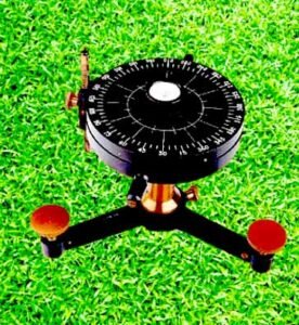
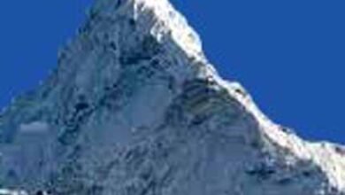
1. Who first used the term ‘Geography’ to describe the Earth? = Greek astronomer Eratosthenes. 2. Which cartographer first displayed the locations in the projection according to their latitude and longitude? = Marinas. 3. Which scholar first measured the earth? = Greek astronomer Eratosthenes. 4. Who authored a book called Metrology? = Robert Hooke. 5. Which line is used to show the distribution of rainfall on a map? = Isoheight. 6. Where is the opisometer used? = Used to measure the length of roads, rivers, and other line features on maps. 7. Which instrument is used to measure high temperature? = Pyrometer or Total Radiation Pyrometer. 8. What are the lines in the map where the pressure is even? = Isobar Lines. 9. What is the device that measures the direction and speed of clouds? = Nephometer. 10. What is the name of the second layer above the three concentric layers of the earth? = It is called the NiFe layer because it is made of Nickel and Iron/Iron. 11. What is the difference between the local time of two places in crossing a longitude? = 04 minutes. 12. Which year was the plate tectonics theory introduced? = The Year1960. 13. What is the number of longitudes? = 360. 14. What is the line joining the north pole and south-pole of the earth? = Axis. 15. Who has proposed the progressive wave theory about the origin of tide and ebb? = William Whewell in the year 1883. 16. What is the reason for the tidal rise in the oceans? = Gravity of the moon. 17. Where is the highest tide in the world? = Bay of Fundy. 18. What is the maximum depth (in meters) of the oceans? = 10,935 metres (35,876 ft). 19. Which is the world’s smallest ocean? = Arctic Ocean. 20. What is the highest salinity of ocean water? = 77.8%. 21. In the oceans, what are the mountain ranges of the site called narrow and long mountain ranges? = Submerged Ridge. 22. Where is the ‘Bermuda Triangle’ located? = An area of the northwest Atlantic Ocean. 23. Who has presented the geo-concave theory related to the origin of coral reefs? = Charles Darwin. 24. Which ocean is suitable for the origin of coral? = Pacific Ocean. 25. How many minutes does the sunlight reach the Earth? = 8 minutes 20 seconds. 26. Due to the presence of which gas, the planet Neptune appears green? = Methane Gas. 27. How much per cent of the total mass of the Earth is found in Mantle? = 68%. 28. Himalaya originated with which property? = Tethys Sea. 29. What is the height of ‘Kanchenjunga’, the main peak of the inner Himalayas? = 8586 meters. 30. Which is the longest mountain in the world? = Andes.
=========== =========== ============ भूगोल से संबंधित–170. 1. पृथ्वी के वर्णन के लिए सर्वप्रथम ‘ज्योग्राफी’ शब्द का प्रयोग किसने किया था? = ग्रीक खगोलशास्त्री एराटोस्थनीज़. 2. सर्वप्रथम किस मानचित्रकार ने प्रक्षेप में स्थानों को उनके अक्षांश व देशान्तरों के अनुसार प्रदर्शित किया था? = मेरीनस. 3. सर्वप्रथम किस विद्वान ने पृथ्वी को मापा था? = ग्रीक खगोलशास्त्री एराटोस्थनीज़. 4. मेटरोलोजिया नामक पुस्तक की रचना किसने की? = रॉबर्ट हुक. 5. मानचित्र पर वर्षा का वितरण दिखाने के लिए किस रेखा का प्रयोग किया जाता है? = आइसोहाइट. 6. ओपीसोमीटर का प्रयोग कहाँ किया जाता है? = मानचित्रों पर सड़कों, नदियों और अन्य रेखा विशेषताओं की लंबाई मापने के लिए किया जाता है. 7. उच्च तापमान के मापन हेतु किस उपकरण का प्रयोग किया जाता है? = पाइरोमीटर या पूर्ण विकिरण उत्तापमापी. 8. मानचित्र में वे रेखाएँ जहाँ दाब सम हो, क्या कहलाती है? = आइसोबार. 9. बादलों की दिशा एवं गति को मापने वाला यन्त्र क्या कहलाता है? = नेफोमीटर. 10. पृथ्वी की तीन संकेन्द्री परतों में ऊपर से दूसरी परत का नाम क्या है? = निफ़े लेयर कहा जाता है क्योंकि यह निकेल और आयरन / आयरन से बनी होती है. 11. एक देशान्तर को पार करने में दो स्थानों के स्थानीज समय के बीच क्या अन्तर होता है? = 04 मिनट. 12. प्लेट विवर्तनिकी सिद्धान्त किस वर्ष प्रस्तुत किया गया? = वर्ष 1967 में मैकेंजी, मॉर्गन व पारकर पूर्व के उपलब्ध विचारों को समन्वित कर ‘प्लेट विवर्तनिकी सिद्धांत‘ का प्रतिपादन किया. 13. देशान्तरों की संख्या कितनी है? = 360. 14. पृथ्वी के ऊत्तरी ध्रुव एवं दक्षिणी ध्रुव को मिलाने वाली रेखा क्या कहलाती है? = अक्ष. 15. ज्वार-भाटा की उत्पत्ति के संबंध में प्रगामी तरंग सिद्धान्त का प्रतिपादन किसने किया है? = वर्ष 1883 में विलियम व्हीवेल. 16. महासागरों में उठने वाले ज्वार-भाटा का क्या कारण है? = चंद्रमा का गुरुत्वाकर्षण. 17. विश्व में सबसे ऊँचा ज्वार कहाँ आता है? = फंडी की खाड़ी. 18. महासागरों की सर्वाधिक गहराई कितनी (मीटर में) है? = 10,935 मीटर (35,876 फीट). 19. विश्व का सबसे छोटा महासागर है? = आर्कटिक महासागर. 20. महासागरीय जल की कितनी सर्वाधिक लवणता पायी जाती है? = 77.8%. 21. महासागरों में स्थल की पर्वत श्रेणियों जैसी संकरी और लम्बी पर्वत श्रेणियों को कहते हैं? = जलमग्न कटक. 22. ‘बरमूदा त्रिकोण’ अवस्थित है? = उत्तर पश्चिम अटलांटिक महासागर का एक क्षेत्र. 23. प्रवाल भित्तियों की उत्पत्ति से सम्बन्धित भू-अवतलन सिद्धान्त का प्रतिपादन किसने किया है? = चार्ल्स डार्विन. 24. कौन-सा सागर प्रवाल की उत्पत्ति के लिए उपयुक्त होता है? = प्रशांत महासागर. 25. सूर्य प्रकाश धरती तक पहुँचने में कितने मिनट लेता है? = 8 मिनट 20 सेकंड. 26. किस गैस की उपस्थिति के कारण वरुण ग्रह हरे रंग का दिखाई देता है? = मीथेन गैस. 27. पृथ्वी के कुल द्रव्यमान का लगभगकितना प्रतिशत मेंटल (Mantle) में पाया जाता है? = 67%. 28. हिमालय की उत्पत्ति किस भूसन्नति से हुई है? = टेथिस सागर. 29. आंतरिक हिमालय की प्रमुख चोटी ‘कंचनजंगा’ की ऊँचाई कितनी है? = 8586 मीटर. 30. विश्व की सबसे लम्बी पर्वतमाला कौनसी है? = एण्डीज.
|