Related to Geography-160.
|
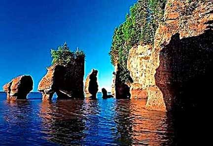
1. Who is considered the father of Geomorphology? = Alexander von Peschel. 2. Who suggested that the Earth originated from gases and dust? = Immanuel Kant. 3. Who first used ‘Geography’ to describe the Earth? = Eratosthenes. 4. What is the science that studies rocks called? = Petrology. 5. Which is the longest mountain range in the world? = Andes Mountains or Andean Mountains 6. Which elevation did the Himalayas originate? = Tethys Sea. 7. What are the tall and narrow mountains found on the surface called? = Mountain range. 8. Who created the Richter scale? = Charles F. Richter and Beno Gutenberg. 9. India is divided into how many seismic zones? = 2, 3, 4 & 5. 10. Where was India’s first biosphere reserve established? = Nilgiri Biosphere Reserve. 11. Which year was the plate tectonics theory presented? = in the year 1967. 12. Which ocean is found to have the maximum extension of the deep oceanic plain? = the Pacific Ocean. 13. Which is the world’s smallest ocean? = the Arctic Ocean. 14. What is the greatest depth (in meters) of the oceans? = 10,935 metres (35,876 ft). 15. Which island does the Agulhas current split into two parts? = Madagascar. 16. ‘El Nino Effect’ is closely related to? = Equatorial Countercurrent. 17. Where does the highest tide come in the world? = Gulf of Fundy. 18. The great tide comes when? = The sun and the moon are in a straight line with each other and pull the sea surface in the same direction. 19. What is the line joining places of equal magnetic inclination called? = Isogonal. 20. Which instrument is used to measure the relative humidity in the air? = Hygrometer. 21. What is the line joining the places coming at the same time of an earthquake called? = Seismic line. 22. The Richter scale is used to measure ?= intensitythethe the of the earthquake. 23. Where will be the longest distance of 1° longitude? = The distance between them is maximum at the equator (111.32 km.). 24. In crossing 1° longitude, there is a difference of how many minutes between the local time of two places? = 04 minutes. 25. What is the reason for the deviation of the International Date Line in the North Pacific Ocean? = the Aleutian Islands. =========== =========== ============ भूगोल से संबंधित-160.
1. भू-आकृति विज्ञान (Geomorphology) का जन्मदाता किसे माना जाता है? = अलेक्जेंडर वॉन पेशेल. 2. किसने सुझाव दिया था की पृथ्वी की उत्पत्ति गैसों और धूल से हुई? = इम्मैनुएल कांत. 3. पृथ्वी के वर्णन के लिए सर्वप्रथम ‘ज्योग्राफी’ शब्द का प्रयोग किसने किया था? = इरेटोस्थेनीज. 4. चट्टानों के अध्यन करने वाले विज्ञान को क्या कहते हैं? = पेट्रोलॉजी (शैलविज्ञान). 5. विश्व की सबसे लम्बी पर्वतमाला कौनसी है? = एंडीज पर्वत या एंडियन पर्वत. 6. हिमालय की उत्पत्ति किस भूसन्नति से हुई है? = टेथिस सागर. 7. धरातल पर पाए जाने वाले लम्बे तथा संकरे पर्वतों को क्या कहा जाता है? = पर्वत शृंखला. 8. रिक्टर स्केल का निर्माण किसने किया था? = चार्ल्स एफ रिक्टर और बेनो गुटेनबर्ग. 9. भारत को कितने भूकंपीय क्षेत्रो में विभाजित किया गया है? = 2, 3, 4 & 5. 10. भारत का सबसे पहला जैवमण्डलीय आरक्षित क्षेत्र कहाँ स्थापित हुआ? = नीलगिरि जैव मंडल. 11. प्लेट विवर्तनिकी सिद्धान्त किस वर्ष प्रस्तुत किया गया? = वर्ष 1967. 12. गम्भीर सागरीय मैदान का सर्वाधिक विस्तार किस महासागर में पाया जाता है? = प्रशान्त महासागर. 13. विश्व का सबसे छोटा महासागर कौन-सा है? = आर्कटिक महासागर. 14. महासागरों की सर्वाधिक गहराई कितनी (मीटर में) है? = 10,935 मीटर (35,876 फीट). 15. किस द्वीप के द्वारा अगुलहास जलधारा दो भागों में विभक्त हो जातीहै? = मेडागास्कर. 16. ‘एल नीनो इफैक्ट’ किसके साथ घनिष्ठ रूप से सम्बन्धित है? = विषुवतीय प्रतिधारा. 17. विश्व में सबसे ऊँचा ज्वार कहाँ आता है? = फंडी की खाड़ी. 18. वृहत ज्वार उस समय आता है, जब? = सूर्य और चंद्रमा एक दूसरे के साथ सीधी रेखा में होते हैं और समुद्र की सतह को एक ही दिशा में खींचते हैं. 19. समान चुम्बकीय झुकाव वाले स्थानों को मिलाने वाली रेखा क्या कहलाती है? = चुंबकीय बल रेखाएं. 20. वायु में आपेक्षिक आर्द्रता मापन हेतु कौन सा उपकरण है? = हाइग्रोमीटर. 21. भूकम्प के एक ही समय पर आने वाले स्थानों को मिलाने वाली रेखा क्या कहलाती है? = सेज्मिक रेखा. 22. रिक्टर स्केल का प्रयोग किसके मापने में किया जाता है? = भूकंप की तीव्रता. 23. 1° देशान्तर की सर्वाधिक दूरी कहाँ पर होगी? = विषुवत रेखा पर इनके बीच की दूरी अधिकतम (111.32 किमी.) होती है. 24. 1° देशांतर को पार करने में दो स्थानों के स्थानीय समय के बीच कितने मिनट का अंतर होता है? = 04 मिनट. 25. उत्तरी प्रशान्त महासागर में अन्तर्राष्ट्रीय तिथि रेखा के विचलन का क्या कारण है? = एल्यूशियन द्वीप समूह.
|

